Trail Map
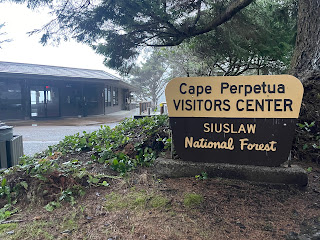
Starting Location: Cape Perpetua Visitors Center (just South of Devil's Churn)
Point of Interest : trails for hiking, with views of ocean
 Length of hike: 2.8 miles from visitor's center to top and back again.
Level: moderate to difficult (mud, some steepness, tree roots)
Bathrooms: Yes, flush toilets at Visitors Center, and at top of Cape
Parking: Large paved lot,
EV Chargers: No
Just 5 of us on this hike. We hoped that the weather would be okay (which is what our weather apps said...). However, it drizzled much of our hike.

We drove to Newport, and took the first picture at Nye Beach, where there are public restrooms. Then on to Cape Perpetua.
There was some confusion about where the trailhead was. Since we were coming from the North, we got to Devils Churn first, but we didn't have time to stop, since we were getting a late start.
There are 4 trails that begin at the Visitor's Center, which is about 1/4 mile south of Devils Churn. Two are pretty short, to Thor's Well, and Devils Churn, which was washed out. There's another trail to Whispering Spruce.

The Saint Perpetua Trail mostly is switchbacks up the Cape, with some great viewpoints of the ocean. Great, that is, unless the fog is so thick it hides the ocean. I could hear it, but visibility was very low.
You can access the trail from the road to the top, or from the campground, if you choose to stay there.
The trail itself has some nice views, with thick forest, lush plants, and lots of cover from sun or rain. The trail itself was in pretty good shape, considering the rain it had received. It is steep in places, and lots of tree roots can either be a hindrance, or helpful steps.
There were some places near the top with steep sides to the trail, but it never felt dangerous. Again, nice views of the ocean (hopefully) as you climb higher.

Did you know you can drive to the top of the Cape? It's true. If you're driving by and have time for a quick view, this is the viewpoint at the top.
Unfortunately, there was no view. We could just barely make out the ocean at the base of the cliff.
We heard about a stone shelter that was on the trail to the north, so we left the viewpoint, and headed north along the trail that parallels the ocean. Not far away, we came upon this stone shelter built in the 1930s.
We had a lot of fun taking pictures of the shelter, and ourselves, as usual. We do not hike for speed.
The fog was annoying, and kept us from a wonderful ocean view. However it did provide some interesting ambiance in the forest. The trails at the top of the cape, by the way, are very flat and easy to hike, so if mobility is an issue, this is your ticket.
We did get some breaks in the weather on the way back down the trail. Hopefully this gives you some idea what is possible.
And of course, the after hike meal is just as important. We tried to stop at a restaurant in Yachats, but it was closed, so we ended up at the
Chowder Bowl at Nye Beach in Newport.
The food was great, the service good, and it was just what we needed for the drive back home.
 Length of hike: 2.8 miles from visitor's center to top and back again.


 Did you know you can drive to the top of the Cape? It's true. If you're driving by and have time for a quick view, this is the viewpoint at the top.


Comments
Post a Comment