Posts

Showing posts from July, 2025

S5 Kayak #3 Beaver Creek

Image
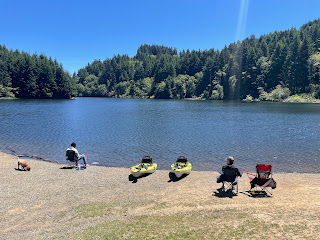
  S5 Kayak #3 Beaver Creek Starting Location:   Boat Ramp at Brian Booth Day Use Area, just off HWY 101 on the East side, across from Ona Beach Point of Interest :  Estuary wildlife and fauna Distance : Just under 4 river miles, 2 in and back Time on float: about 3 hours Bathrooms:  1 vault toilet at Day Use Area, another at Kayak launch upriver Parking : EV Chargers :  no Rentals:  no This is actually where we went for our first kayak trip with our new kayaks, 4 years ago. We remembered liking the abundant nature, and easy paddle. We put in at the Brian Booth Day use area just off Hwy 101, right across from the Ona Beach State Park. If you park at Ona Beach, you can drag your kayak to Beaver Creek, but there's not an official boat ramp. There is also a kayak launch farther down Beaver Creek road. We ended up paddling upstream to that launch, and then back. We had timed the tide so that we got there at slack tide, as high tide was ending, so we would ...

S5 Hike #11 Munson Creek Falls

Image
S5 Hike #11 Munson Creek Falls Starting Location:  parking lot at end of gravel road off of Hwy 101 near Tillamook. Point of Interest :  waterfall (tallest in coast range) Distance : 1/4 mile each way Difficulty : Easy, a bit steep in places. Not sure what trail looks like when wet. Bathrooms:  port a potty Parking : yes, small gravel lot EV Chargers :  No I've seen the signs for this State Natural Site every time we've gone to Tillamook, but never stopped until now. I was driving alone, so that helped. I turned off Hwy 101 just south of Tillamook, in Pleasant Valley. The hike is very short, only 1/4 mile. The whole time there's a small creek babbling alongside the trail, and the forest vegetation was very lush and green, which made it a bit difficult to see the waterfall. It's a tall one, over 300 feet, and apparently the tallest in the Coast Range.  There are 2 vantage points you can stop at for a view. The last one on the trail isn't that much clos...

S5 - Kayak #2 Big Creek Reservoir, Newport

Image
S5 - Kayak #2 Big Creek Reservoir, Newport Starting Location: Boat Ramp at start of Big Creek Reservoir #2 Point of Interest : flatwater, waterfowl, fishing Distance : Decent sized lake, narrow, just under a mile long. Time on float : up to you. Bathrooms : 1 port a potty Parking : Minimal, gravel EV Chargers : No  Rentals : No Big Creek road is just to the right as you are heading out of Newport to the North. If you follow it, you come to a dead end sign, and then a gravel road that heads off to the left along the reservoir. Yes, this is the right way to go. The road is gravel, but in good repair, but it gets narrow in places, where 2 cars going opposite directions would have issues. Eventually, after about a mile, you get to this small gravel boat launch area. We were here on a Monday afternoon, so not many people were here, no boaters, just a few fishermen. The lake is quiet (no motors), with lots of nature to enjoy. There are quite a few spots you could pull up to if you want...

S5 Camping # 3 Moonshine Park

Image
  Moonshine Park Starting Location:  Our Campsite B6 Point of Interest  :   views, waterfall Length of hike:  .2 mile loop Level :  Easy - paved trail until going down to the river Bathrooms :  yes, flush, clean, with showers (free) Parking :  Day Use or at campsite EV Chargers:   No Firewood : yes $7 a bundle We returned to Moonshine Park right after the 4th of July weekend. We were lucky to get a campsite for 2 days, Saturday and Sunday. Last time we were here, we did not take time to try out the 2 swimming holes. That was our goal this time, and it was so worth it.  The water was cool, but we got used to it pretty quickly. It's an easy swim over to the waterfall, where you can get behind it a bit. There wasn't a lot of water coming down, but it was much colder than the river. There's another swimming hole upriver a short walk. Quite a few people were coming down river in tubes and floaties. I'm not sure where they were putting in...